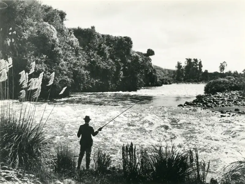
The Manawatū River page is for anglers who need two decisions before buying: which side of Maunga Road Bridge the session uses, and whether the planned bank is actually accessible. The Wellington regulation row and the official access guides answer different parts of that problem.
This page is narrower than the Wellington region guide. It also differs from the Upper Rangitīkei designated-water page: the Manawatū rows use the ordinary Fish & Game Wellington licence path, not a designated-water licence stack.
Manawatū River Rule Path
Name the reach first, then separate the legal fishing row from the access route.
| Planning layer | Manawatū decision |
|---|---|
| L1 authority | Wellington Fish & Game |
| L2 water | Manawatū River |
| L3 action | Check Maunga Road Bridge, season, method, bag, access, and buying path |
The river runs from the Ruahine side through the Gorge and Palmerston North corridor toward Foxton. The official access guides split the practical plan into upper reaches and lower reaches, while the regulations use Maunga Road Bridge as the rule boundary.
Current Manawatū Rule Rows
As checked against the Wellington 2025/26 sports fishing regulations, the current named-water table lists two Manawatū rows.
| Manawatū water or section | Season | Methods | Daily bag shown | Size | Notes |
|---|---|---|---|---|---|
| Upstream of Maunga Road Bridge, which is upstream of Dannevirke | 1 Oct-30 Apr | FS | 1 | No Manawatū-specific size note shown | Fly and spin only in this row |
| Downstream of Maunga Road Bridge, which is upstream of Dannevirke | All year | FSB | 2 | No Manawatū-specific size note shown | Bait is included in this row |
FS means artificial fly and spinner. FSB adds bait. Do not extend the lower row's bait permission across the upper reach.
The 2025/26 season is the current source set checked on 5 August 2026. Reopen the next Wellington notice before relying on these dates after 30 September 2026.
The Maunga Road Bridge Split
Maunga Road Bridge is the L3 rule boundary. It changes the open season, method code, and daily bag.
| Trip plan | Rule action |
|---|---|
| Upstream of Maunga Road Bridge | Check 1 Oct-30 Apr, FS, and one fish |
| Downstream of Maunga Road Bridge | Check all-year, FSB, and two fish |
| Maunga Road Bridge access point | Follow the negotiated access conditions in the official upper guide |
| Palmerston North or Manawatū Gorge plan | Use the lower access guide, then match the named river row |
| Foxton mouth or beach plan | Separate freshwater sports-fishing rules from MPI marine rules |
The bridge is not a general permission marker. It is only the boundary printed in the current regulation row; the access route may have its own gate, landowner, quarry, or walkway condition.
Upper River Access And Permission
Fish & Game's upper access guide covers the river between Norsewood and Woodville. It says some riverbed sections may be privately owned, and anglers do not necessarily have a right of access. At Maunga Road, the guide says there is no legal public access immediately upstream or downstream of the bridge and that Fish & Game has arranged access with adjoining landowners.
| Upper-river situation | Safer action |
|---|---|
| Maunga Road Bridge | Follow the negotiated conditions and do not block gateways |
| Oringi Road or other organised access | Use the signed access and comply with the guide's conditions |
| Private riverbed or farmland edge | Stay within the permitted riverbed and seek permission when unsure |
| SH2, railway, or bridge parking | Park clear of traffic, gates, and working routes |
| New access point not in the guide | Treat the PDF as dated planning guidance and verify locally |
A Fish & Game licence authorises sports fishing; it does not authorise trespass, vehicle access on the riverbed, camping, fires, or ignoring a landowner condition.
Palmerston North And Lower-River Access
Fish & Game's lower access guide covers the Manawatū Gorge to Foxton Beach. It describes good access from the Palmerston North city walkway, fewer access points below Palmerston North, and limited opportunities downstream of Opiki Bridge because of access and water clarity.
| Lower-river plan | Access and rule action |
|---|---|
| Manawatū Gorge or Ashhurst Bridge | Check the lower access guide, parking, river condition, and current row |
| Palmerston North city walkway | Use the public walkway access but check bank condition, signs, and local works |
| Downstream of Palmerston North | Expect fewer access points and check the actual legal route |
| Opiki Bridge | Use the official access contact or public marginal-strip information; do not assume open access |
| Foxton Beach or river mouth | Check the freshwater row for sports fish and MPI rules for marine species |
The lower guide also mentions perch around Palmerston North and downstream, alongside non-sports fish such as mullet, kahawai, and herring near the lower river and mouth. Species context does not replace the authority check.
Foxton Mouth Boundary
Foxton Beach and the river mouth can turn one itinerary into two rule systems. The access guide describes fishing for non-sports fish at the boat ramp and mouth, with occasional sea-run trout for which a licence is required.
| Target or session | Authority action |
|---|---|
| Trout or other freshwater sports fish in the river | Fish & Game Wellington licence and current Manawatū row |
| Perch in the lower river | Fish & Game row plus current species and method reading |
| Mullet, kahawai, or herring as marine/coastal catch | Open MPI recreational fishing rules |
| Mixed river and beach day | Keep Fish & Game and MPI checks separate |
| Sea-run trout mentioned at the mouth | Confirm the current official freshwater rule before treating it as a marine catch |
Do not use a generic “river mouth” assumption to decide which authority applies. Identify the exact water and target species first.
Licence And Buying Actions
Buy after the reach, method, access, and angler category are clear.
| Angler plan | Buying path |
|---|---|
| Upper Manawatū resident trip | Confirm the upper FS row and access conditions, then buy Fish & Game |
| Lower Manawatū resident trip | Confirm the lower FSB row and public or negotiated access, then buy Fish & Game |
| Non-resident visitor | Check Fish & Game non-resident status and duration before paying |
| Family or junior plan | Match each angler's licence category to the method and retained-fish plan |
| Foxton mixed trip | Fish & Game for freshwater sports fish; MPI rules for marine fishing |
The online buying path is an action after the water decision, not a substitute for it.
Before Fishing The Manawatū
- Confirm the session is Wellington Fish & Game freshwater fishing.
- Place the water upstream or downstream of Maunga Road Bridge.
- Open the current Wellington regulations and match season, methods, bag, and notes.
- Open the upper or lower access guide for the actual access point.
- Check gates, negotiated access, private riverbed, quarry operations, river condition, weather, and daylight.
- Separate Foxton mouth, beach, or marine targets into an MPI rule check.
- Buy the correct Fish & Game product after the reach and angler category are settled.
The Manawatū plan is ready when the Maunga Road row and the actual access route both agree with the date, method, and target species.
FAQ
Do I need a Fish & Game licence for the Manawatū River?
Yes. Freshwater sports fishing on the Manawatū River is in the Wellington Fish & Game rule path, subject to the current regional notice and exact reach.
What authority applies at the Foxton mouth?
Use Fish & Game for the freshwater sports-fishing session and its named river row. If the plan becomes coastal or marine fishing at the mouth or beach, check MPI recreational fishing rules for that part.
Is the Manawatū River open all year?
No. The current row upstream of Maunga Road Bridge runs from 1 October to 30 April. The row downstream of Maunga Road Bridge is all year; the current booklet notes that the bridge is upstream of Dannevirke.
What is the Manawatū access trap?
A Fish & Game licence does not make every bank public. The official upper and lower access guides describe negotiated access, private riverbed, quarry operations, gates, and sections where permission is required.